


Bloom 48 Voting District, Cook County, Illinois
About
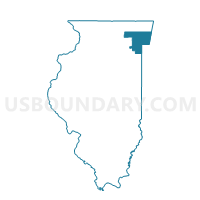
Outline

Summary
| Unique Area Identifier | 567977 |
| Name | Bloom 48 Voting District |
| County | Cook County |
| State | Illinois |
| Area (square miles) | 0.11 |
| Land Area (square miles) | 0.11 |
| Water Area (square miles) | 0.00 |
| % of Land Area | 100.00 |
| % of Water Area | 0.00 |
| Latitude of the Internal Point | 41.53262310 |
| Longtitude of the Internal Point | -87.64583600 |
Maps


Graphs
Select a template below for downloading or customizing gragh for Bloom 48 Voting District, Cook County, Illinois


Neighbors
Neighoring Voting District (by Name) Neighboring Voting District on the Map
- Bloom 3 Voting District, Cook County, IL
- Bloom 56 Voting District, Cook County, IL
- Bloom 57 Voting District, Cook County, IL
- Bloom 58 Voting District, Cook County, IL
- Bloom 59 Voting District, Cook County, IL
Top 10 Neighboring County Subdivision (by Population) Neighboring County Subdivision on the Map
Top 10 Neighboring Place (by Population) Neighboring Place on the Map
Top 10 Neighboring Elementary School District (by Population) Neighboring Elementary School District on the Map
Top 10 Neighboring Secondary School District (by Population) Neighboring Secondary School District on the Map
- Bloom Township High School District 206, IL (64,796)
- Homewood-Flossmoor Community High School District 233, IL (38,253)